Cypress & Shoal Creek Public Space Strategy
Shoal Creek conservancy is excited to announce their draft public space strategy that envisions the potential future of the district on their Cypress & Shoal Public Space Strategy community engagement headquarters. Input on transforming Cypress & Shoal Creek is highly valued by the conservancy, who will be accepting input from the public until January 31st. Below you can view the public outreach summary from 2020, as well as detailed information on each of the five project areas, including: a summary of existing conditions and public input, imagery to illustrate proposed design concepts, and the Draft Public Space Strategy for the area. Please visit the Cypress & Shoal Creek Public Strategy Page to leave your feedback.
PUBLIC OUTREACH SUMMARY: SPRING 2020
MARGARET MOSER PLAZA
- congested plaza and street
- confusing bike connection
- not enough space for all uses
- too many cars
- no scooter parking
CONVERGENCE PLAZA
- creek trail is poorly lit and feels unsafe
- trash not cleaned regularly
- blind crossings and hairpin turns are challenging for cyclists
- could use more places to sit
MARKET PLAZA
- confusing vehicular intersection
- dangerous crosswalk
- redundant drive streets
- not enough bike parking
- poor landscaping and maintenance
- not enough shade
BOWIE STREET UNDERPASS
- create safe connections for bikes and pedestrians
- wider sidewalks
- put vacant land to good use
- deal with train noise
SHOAL CREEK TRAIL
- widen the trail
- create a safer trail
- clean up trash and unsafe behavior
- create passive seating areas
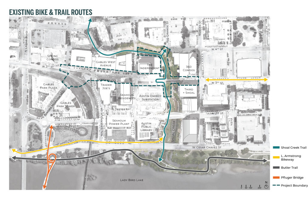
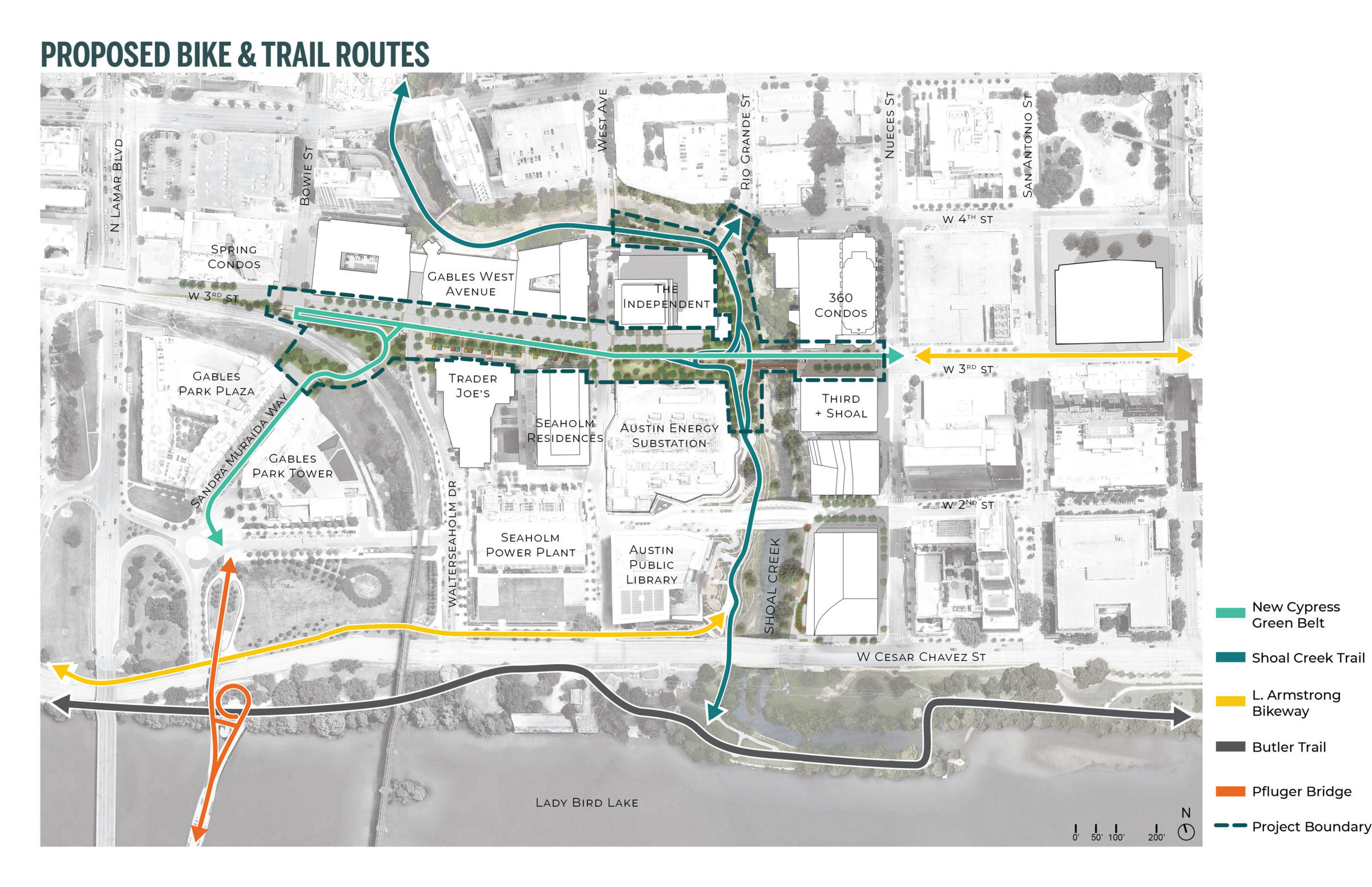
EXISTING BIKE & TRAIL ROUTES
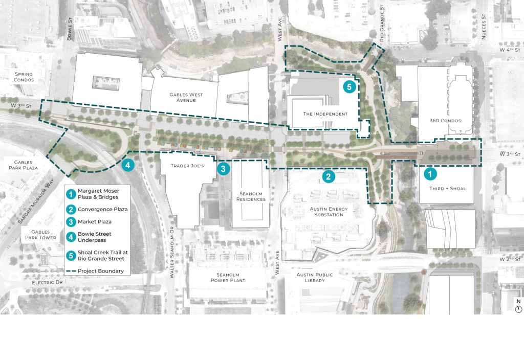
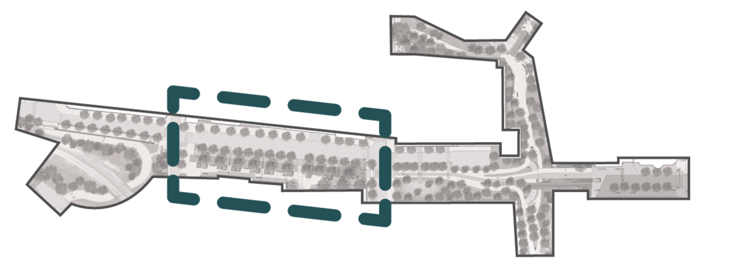
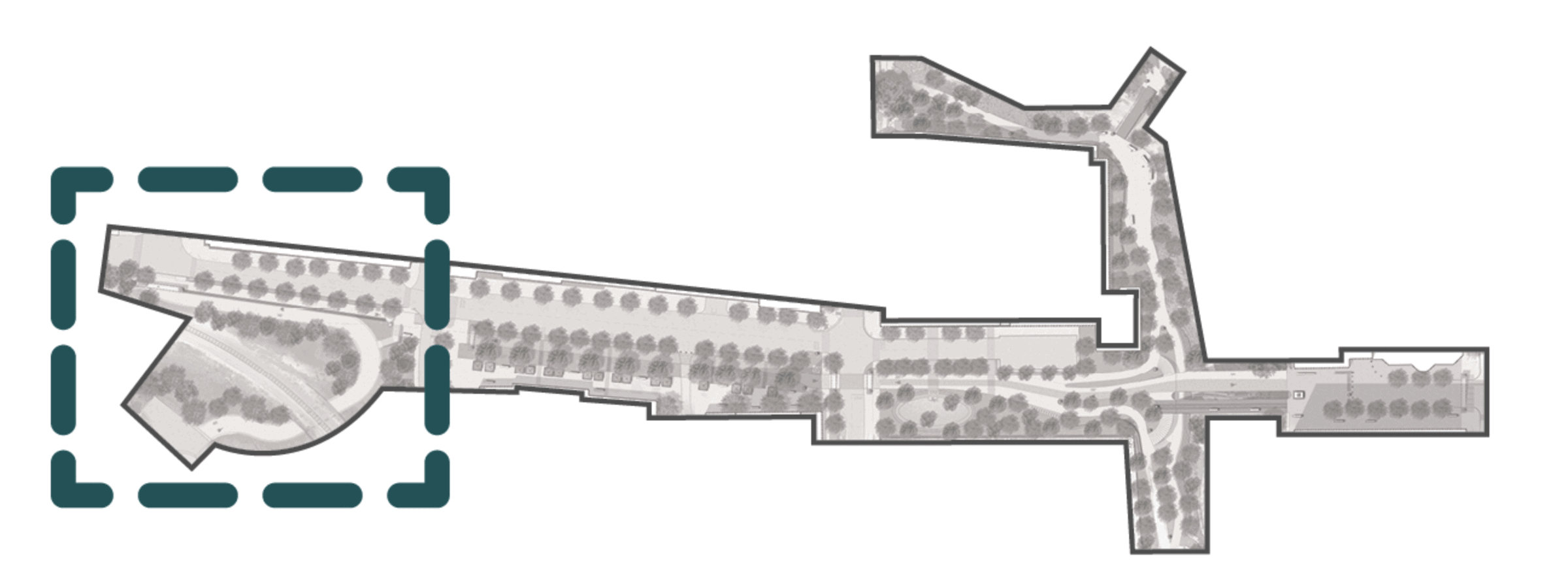
CYPRESS & SHOAL CREEK: PROJECT AREAS
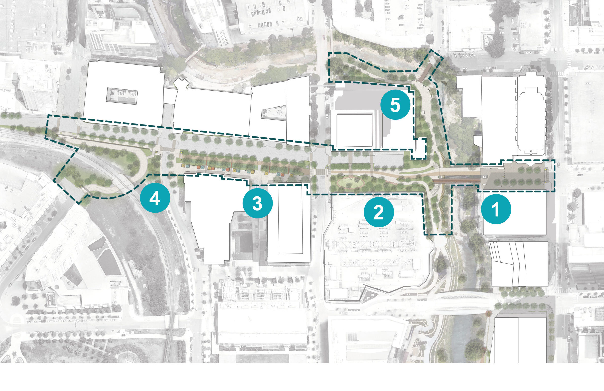
1. MARGARET MOSER PLAZA & 3RD STREET BRIDGES
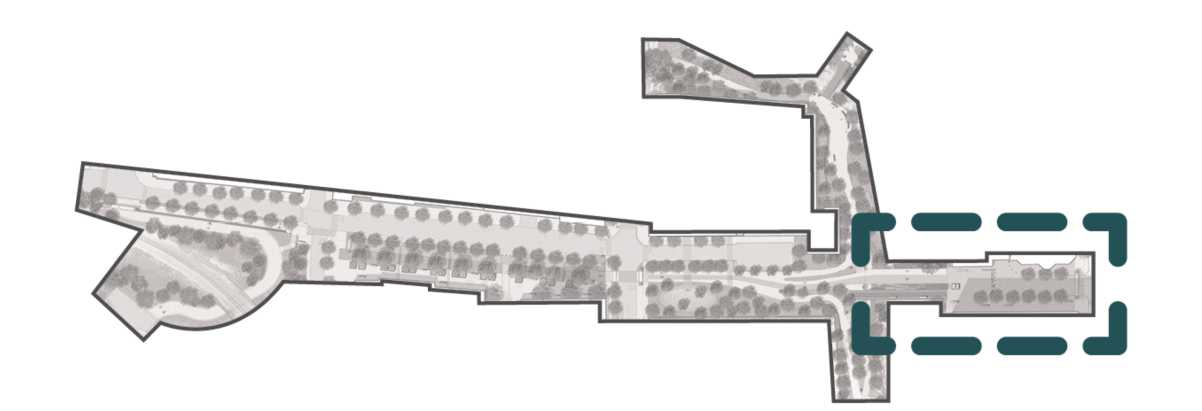
Area of 3rd Street between the 360 Condos and Third + Shoal buildings, continuing over Shoal Creek via two renovated bridges.
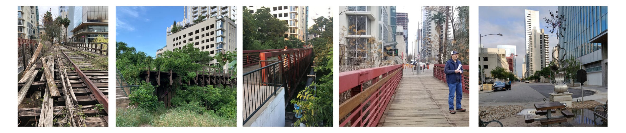
MARGARET MOSER PLAZA & 3RD STREET BRIDGES: TODAY
PUBLIC FEEDBACK SUMMARY
- congested plaza and street
- confusing bike connection
- not enough space for all uses
- too many cars
- no scooter parking
OPPORTUNITIES
- streamline traffic for safety and convenience
- create easier bike connections
- restore historic railroad bridge for pedestrians
- provide views of Lady Bird Lake
- improve water quality of street stormwater runoff
CONSTRAINTS
- city utilities spanning Shoal Creek
- decaying railroad bridge
- narrow commuter bridge
- busy plaza
- flood plain of shoal creek
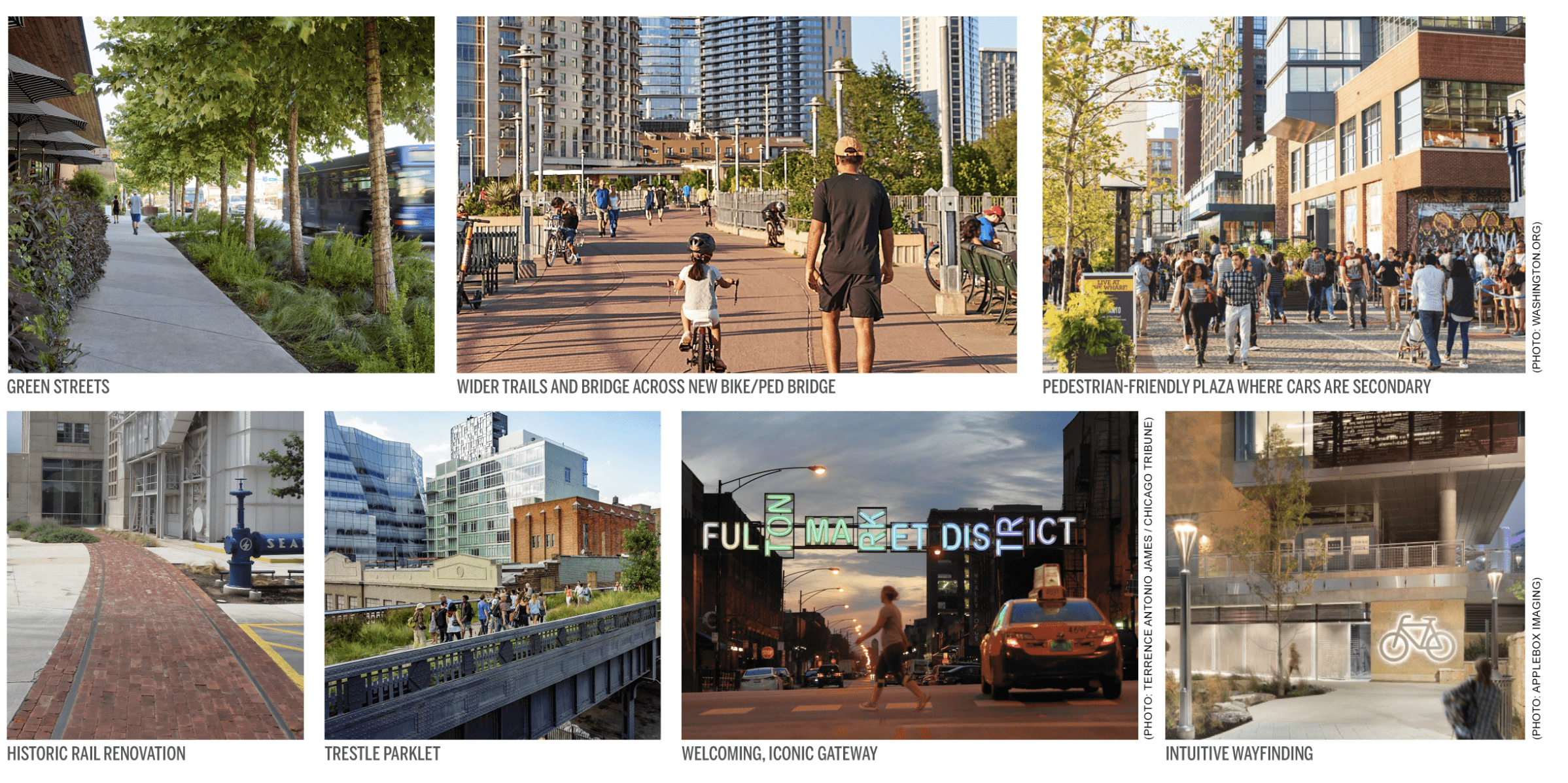
MARGARET MOSER PLAZA & 3RD STREET BRIDGES: CONCEPTS
- separated pedestrian and bike lanes across new bike/ped bridge
- people-dominated plaza plaza specs where cars yield to pedestrian traffic
- wider pedestrian bridge for bikes, scooters, pedestrians and pets
- green streets with shade trees for health and comfort
- clear directional signs
- gateway element for district identity
- restoration of the historic rail line
- park space on old trestle bridge
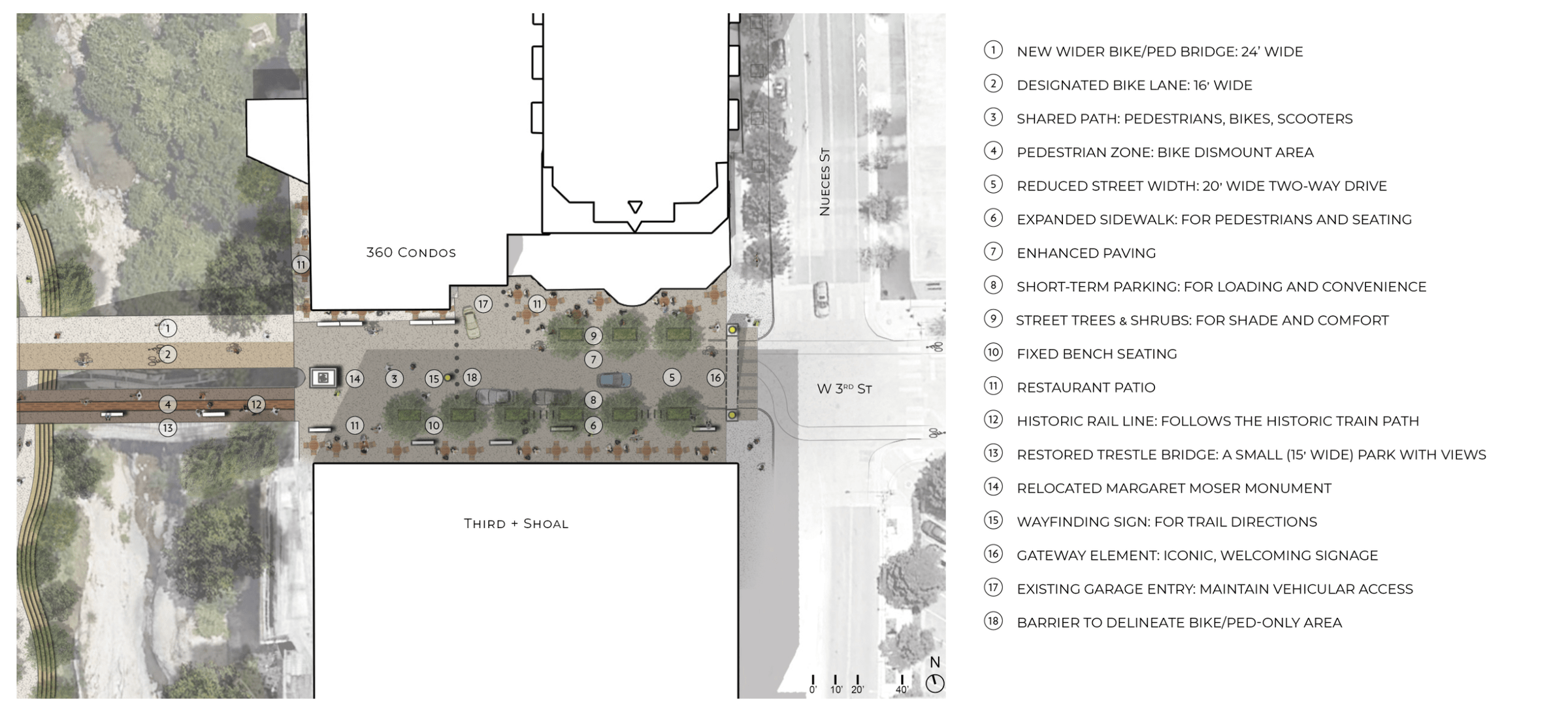
MARGARET MOSER PLAZA & 3RD STREET BRIDGES: IN THE FUTURE
PLAZA GOALS
- manage bikes, cars and people
- improve safe crossings for all
- narrow drive lanes and slow cars
- improve and widen sidewalks
- streamline the bike connection
- incorporate sustainable design techniques
BRIDGE GOALS
- new, wider commuter bridge
- restore trestle bridge for public use and creek crossing
- no impact to creek flood plain
- provide a new, safe trail under bridges
KEY PLAN
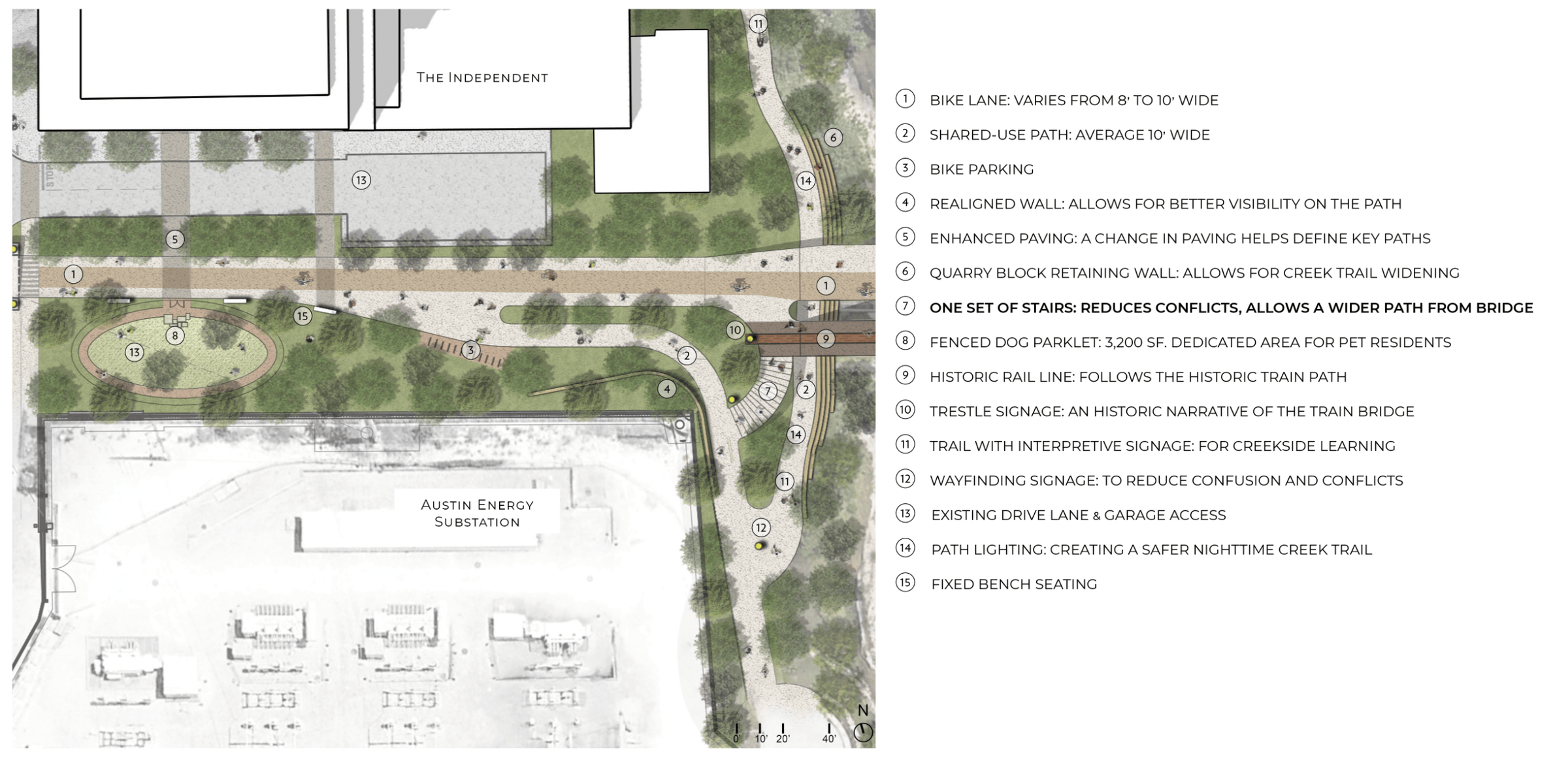
2. CONVERGENCE PLAZA
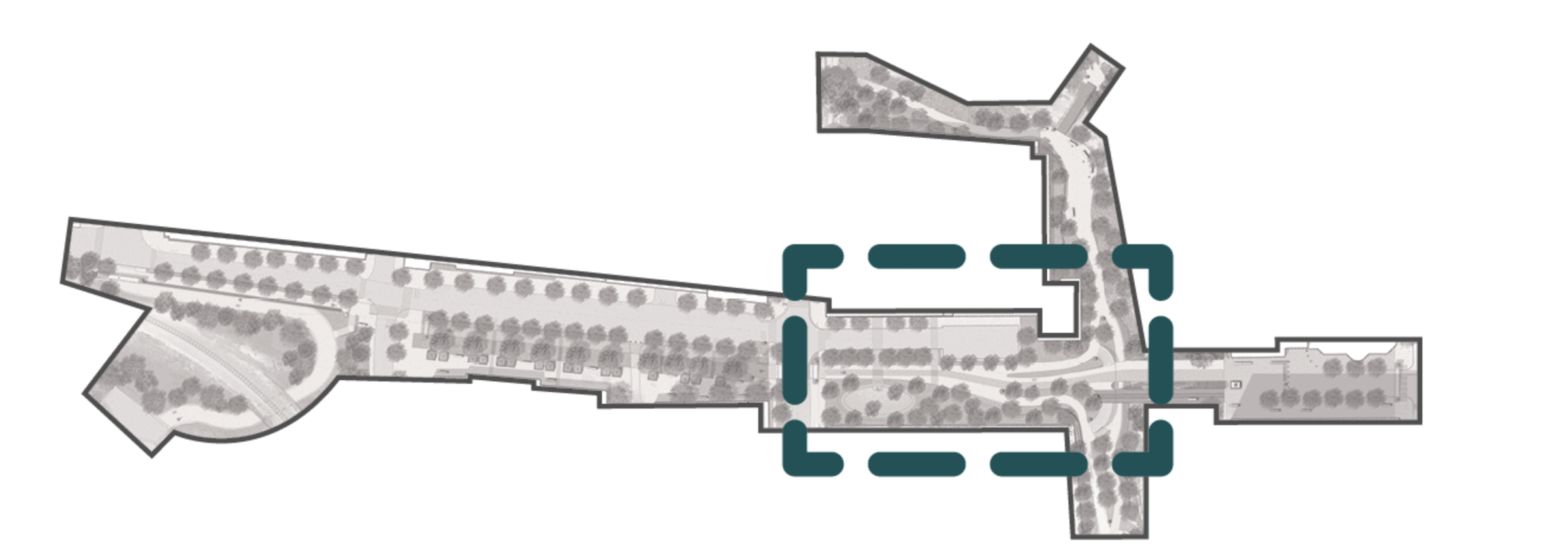
Area between The Independent and the Austin Energy substation, at the convergence of 3rd Street and the Shoal Creek Trail.
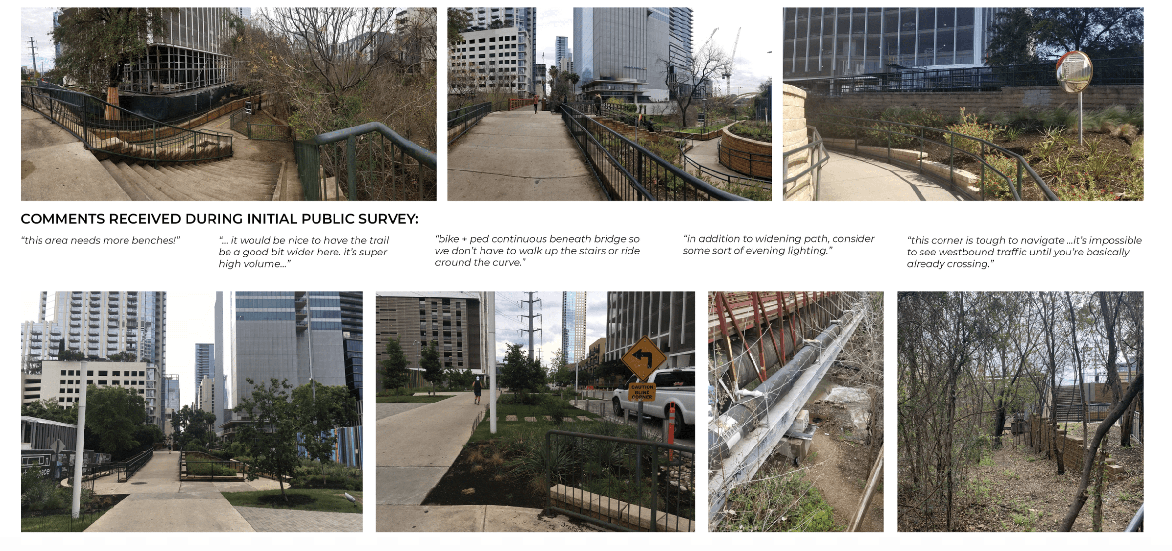
CONVERGENCE PLAZA: TODAY
PUBLIC FEEDBACK SUMMARY
- creek trail is poorly lit and feels unsafe
- trash not cleaned regularly
- blind crossings and hairpin turns are challenging for cyclists
- could use more places to sit
OPPORTUNITIES
- provide a continuous trail along the creek
- improve lighting along the creek trail
- widen paths for pedestrians and bikes
- improve areas around Austin Energy land for public use
CONSTRAINTS
- overhead and underground utilities
- confusing traffic crossings and conflicts
- significant grade changes
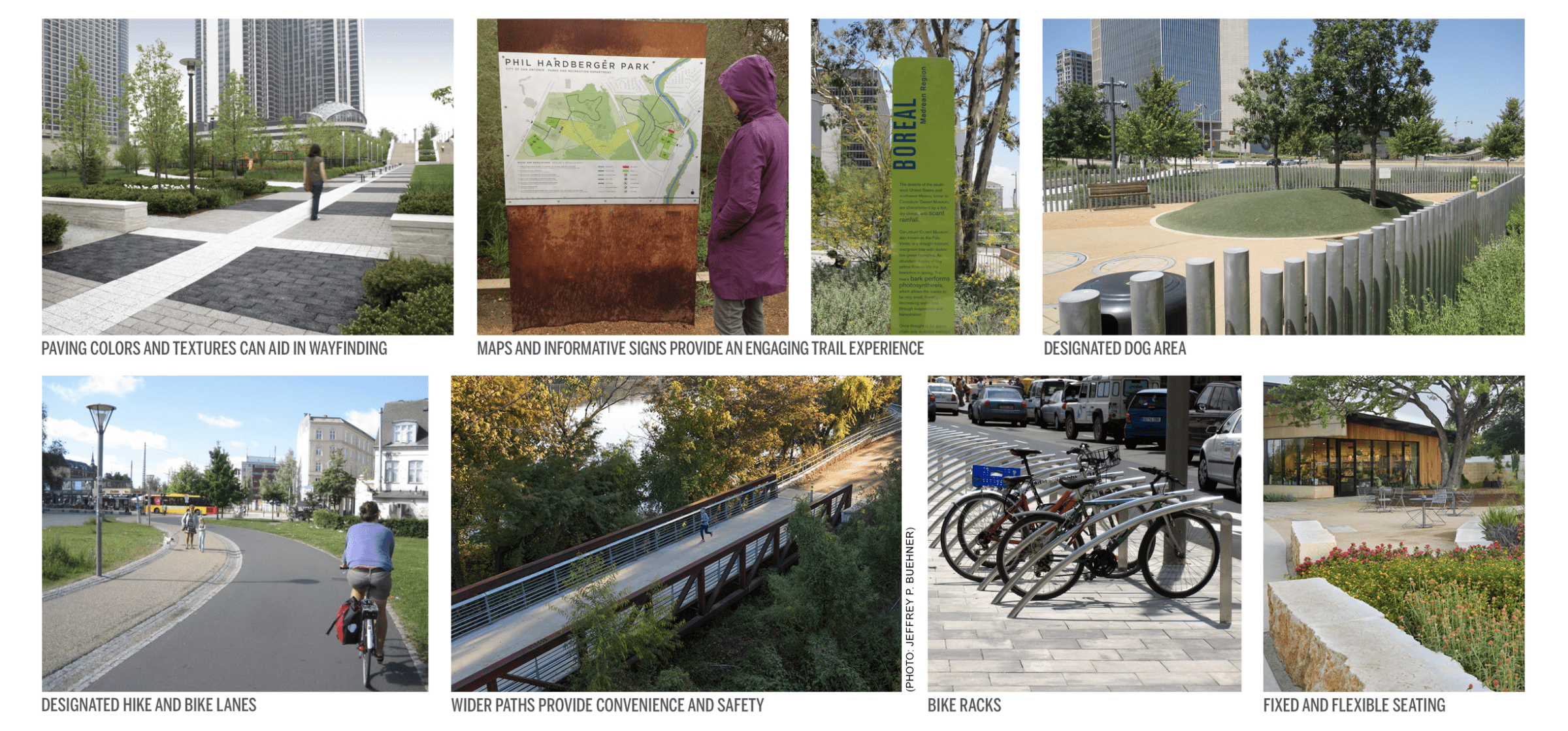
CONVERGENCE PLAZA: CONCEPTS
- dedicated bike lanes
- wider paths
- dog park for residents and to reduce landscape damage
- educational and wayfinding signage
- use special paving colors or patterns to aid in wayfinding
- utilize open space
- provide space for seating
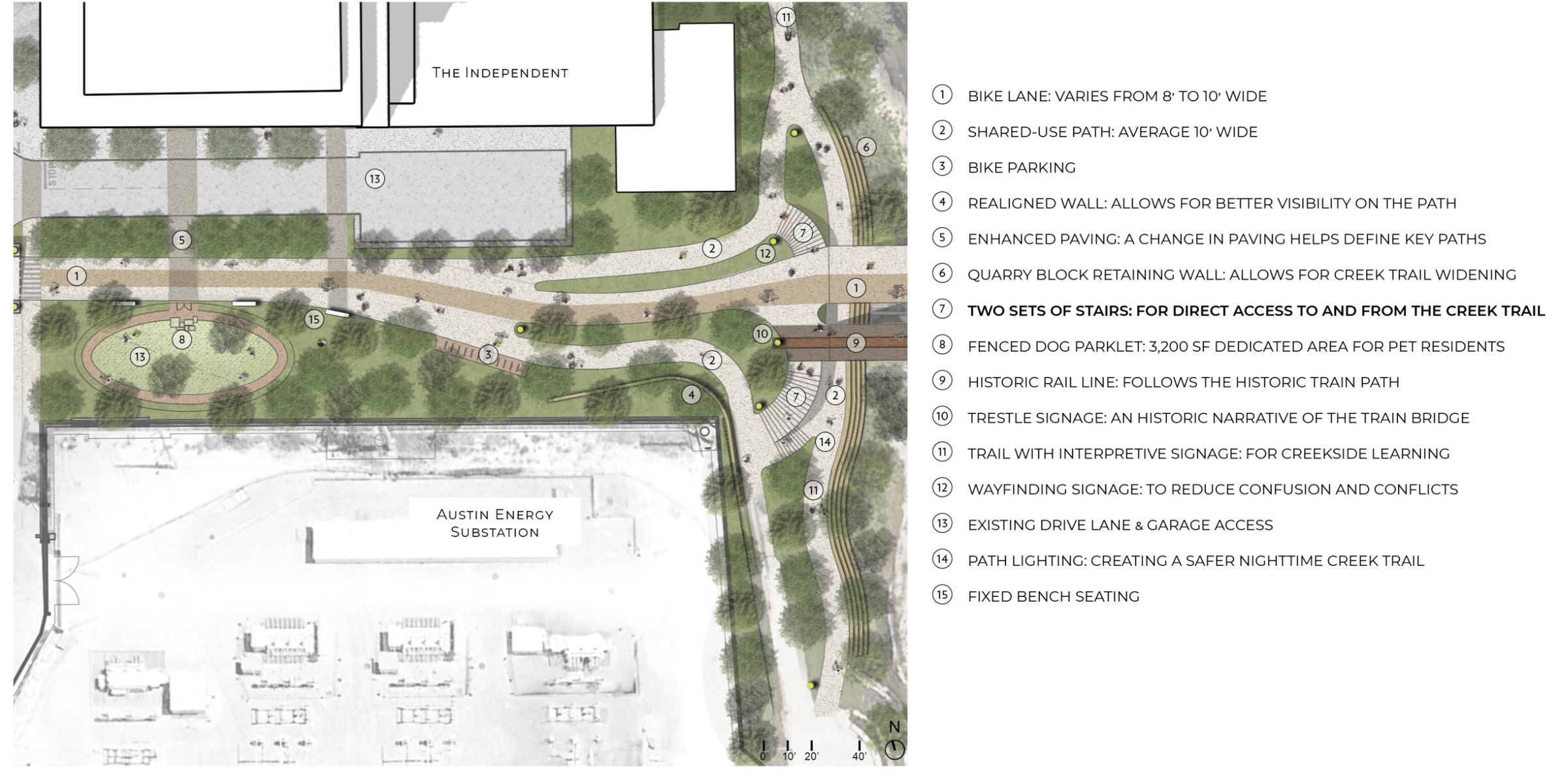
CONVERGENCE PLAZA: IN THE FUTURE (OPTION 1)
PLAZA GOALS: EAST-WEST
- dedicated bike lanes
- reduce bike and pedestrian conflicts
- connectivity to new development
- utilize open space
- wider paths
CREEK TRAIL GOALS: NORTH-SOUTH
- continue trail under bridges
- interpretive/educational signage
- wider paths
- safer conditions
KEY PLAN
CONVERGENCE PLAZA: IN THE FUTURE (OPTION 2)
PLAZA GOALS: EAST-WEST
- dedicated bike lanes
- reduce bike and pedestrian conflicts
- connectivity to new development
- utilize open space
- wider paths
CREEK TRAIL GOALS: NORTH-SOUTH
- continue trail under bridges
- interpretive/educational signage
- wider paths
- safer conditions
KEY PLAN
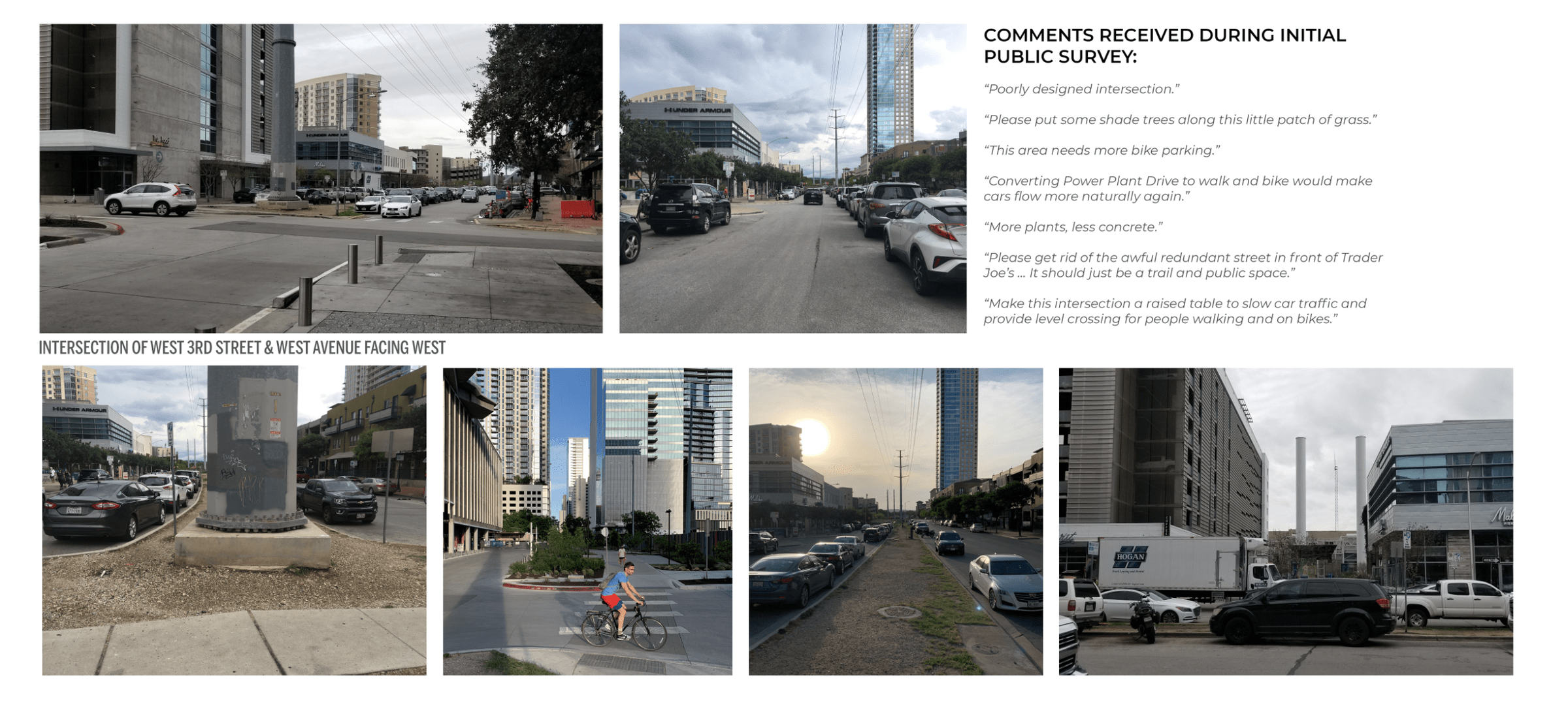
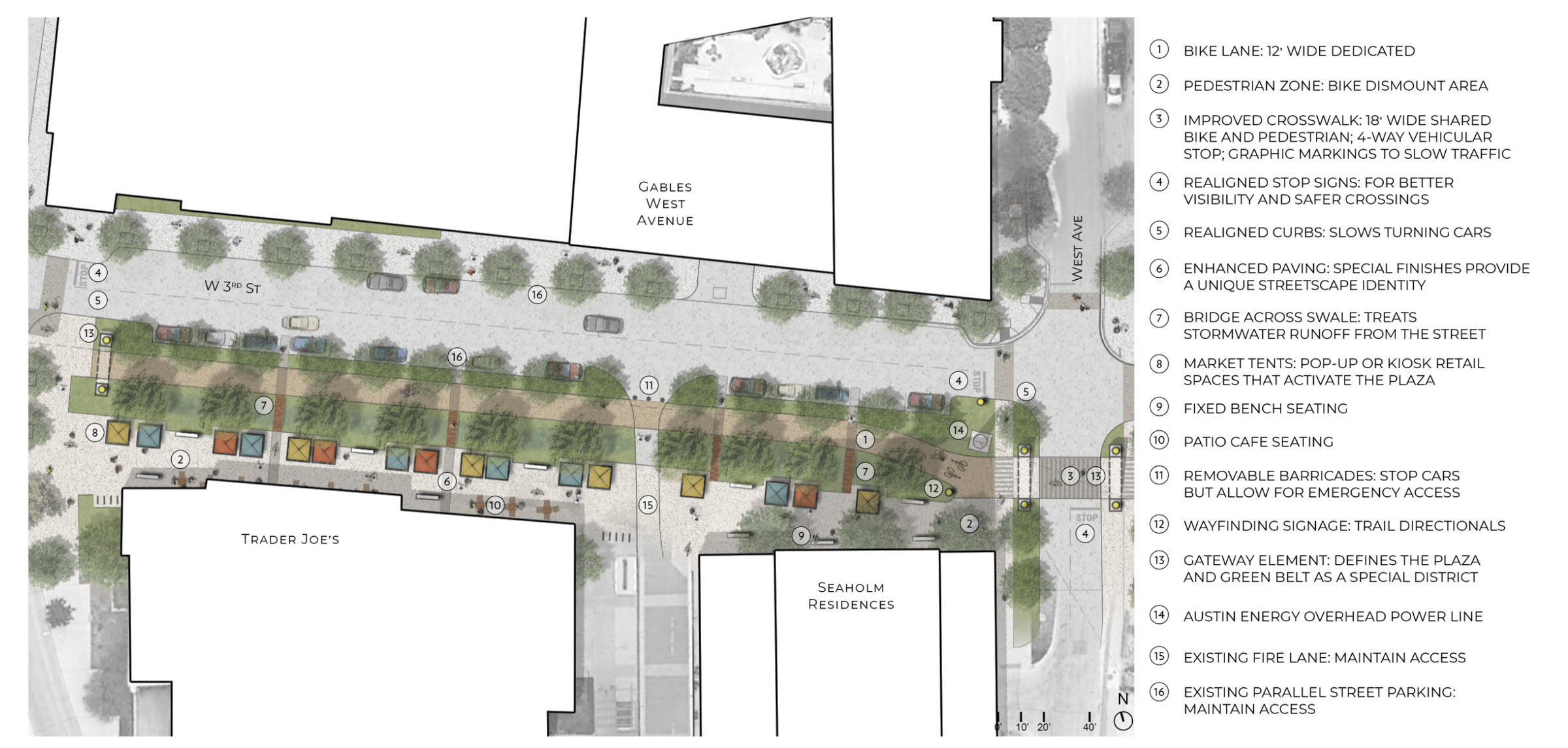
3. MARKET PLAZA
Area of 3rd Street and Power Plant Drive between Trader Joe’s/Seaholm Residences and the Gables West Avenue apartment building, reimagined as a public plaza.
MARKET PLAZA: TODAY
PUBLIC FEEDBACK SUMMARY
- confusing vehicular intersection
- dangerous crosswalk
- redundant drive streets
- not enough bike parking
- poor landscaping and maintenance
- not enough shade
OPPORTUNITIES
- provide safer intersections
- introduce more shade
- improve water quality from street runoff
- designated bike path
- better pedestrian experience
- re-vegetate the median with native plants
CONSTRAINTS
- vehicular access and parking needs
- fire department access
- Austin Energy overhead power lines
- pet relief needs
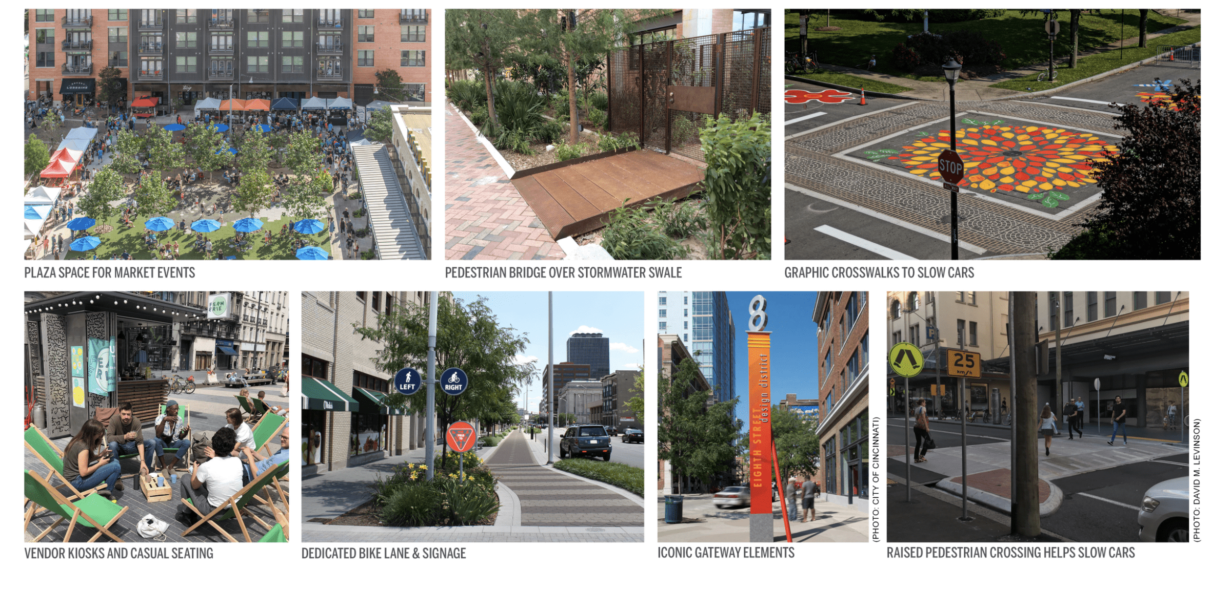
MARKET PLAZA: CONCEPTS
- dedicated bike lane
- dedicated pedestrian plaza
- pop-up retail opportunities
- stormwater treatment from street runoff
- safer crosswalk
- tighter turning radius for cars and shorter crosswalks
- bold graphic markings to slow traffic
- speed hump slows cars at crosswalks
MARKET PLAZA: IN THE FUTURE
GOALS:
- reduce vehicular dominance
- repurpose redundant parallel streets for pedestrians and bikes
- provide safer crossings and reduce confusion
- provide dedicated bike
- improve pedestrian experience
- maintain street parking
- increase retail opportunities, such as pop-up markets
- manage stormwater runoff
- connect to future Bowie Street underpass
KEY PLAN
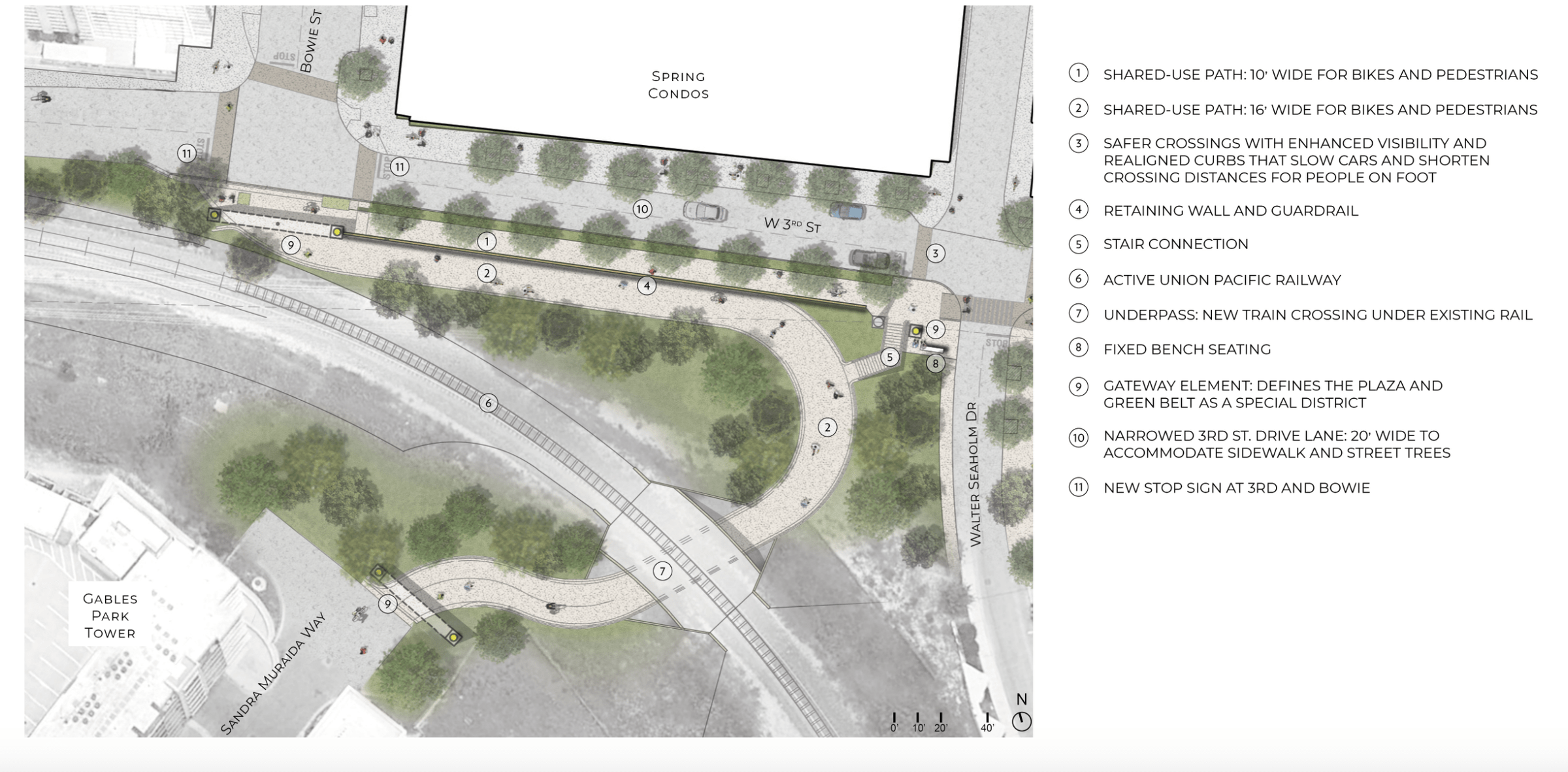
4. BOWIE STREET UNDERPASS
Connection of Bowie Street underneath the Union Pacific rail line, linking up with Sandra Muraida Way and ultimately to the Ann and Roy Butler Hike-and-Bike Trail around Lady Bird Lake.
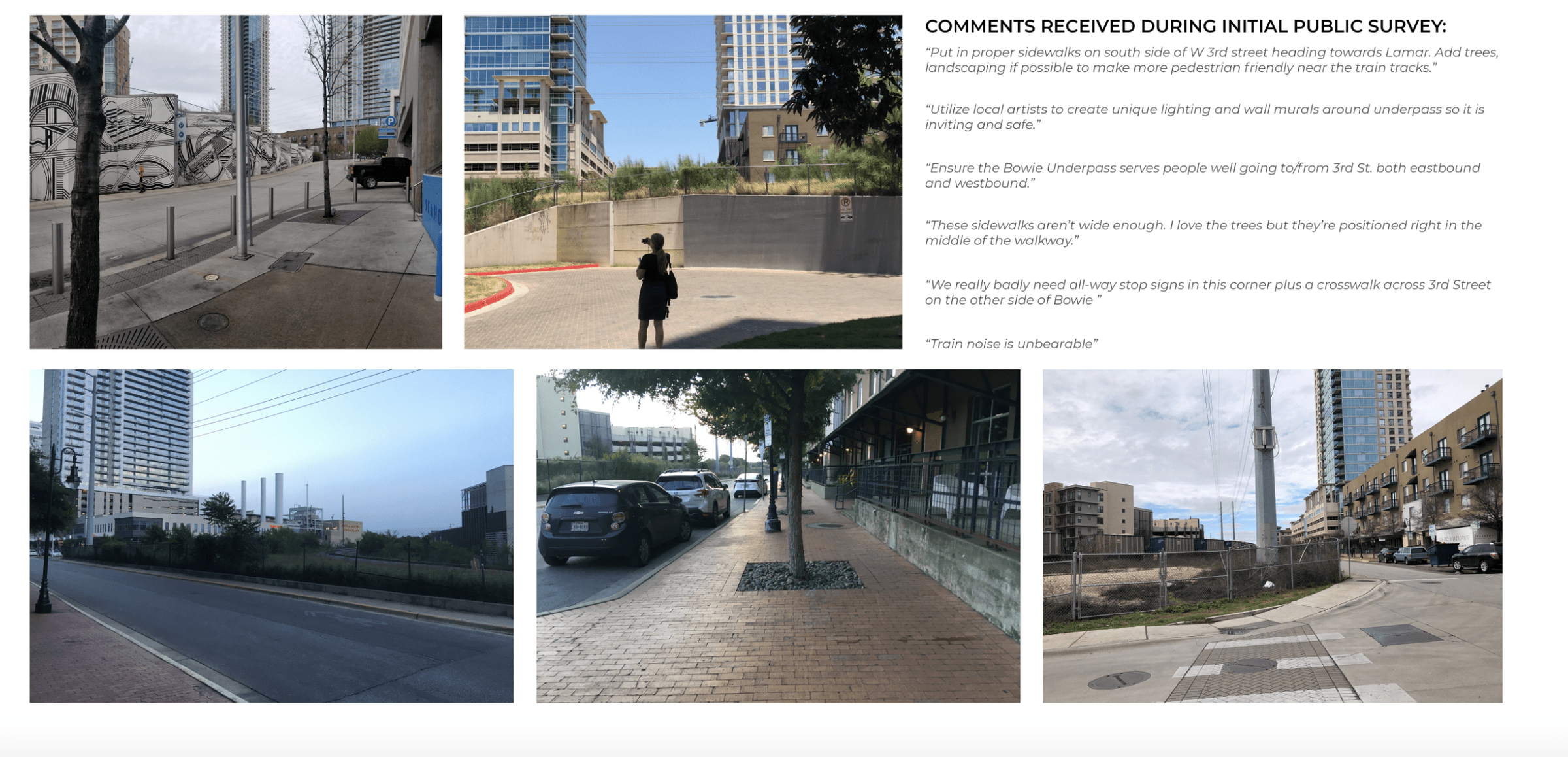
BOWIE STREET UNDERPASS: TODAY
PUBLIC FEEDBACK SUMMARY
- create safe connections for bikes and pedestrians
- wider sidewalks
- use vacant city-owned property next to the train line for improved streetscape
OPPORTUNITIES
- create designated bike & pedestrian connection to Pfluger bridge
- create safer crossings
- provide shaded sidewalks
CONSTRAINTS
- Union Pacific active railway
- Austin Energy overhead power lines
- narrow roadway
- significant grade changes
BOWIE STREET UNDERPASS: CONCEPTS
- wide shared path
- trestle underpass structure
- street trees
- improved crossing
- gateway element
BOWIE STREET UNDERPASS: IN THE FUTURE
GOALS:
- create a designated bike & pedestrian connection to Pfluger bridge
- create safer crossings
- provide wider sidewalks
- provide shaded paths
KEY PLAN
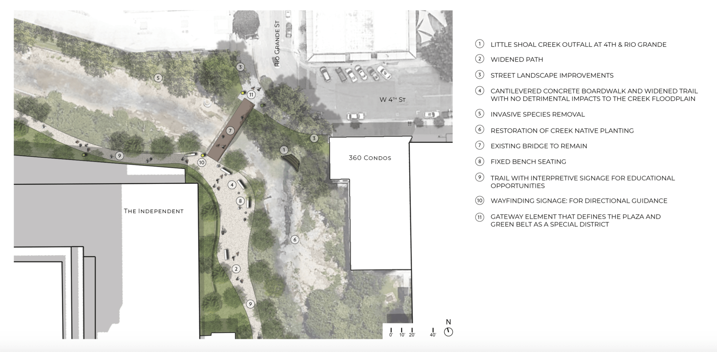
5. SHOAL CREEK TRAIL AT RIO GRANDE STREET
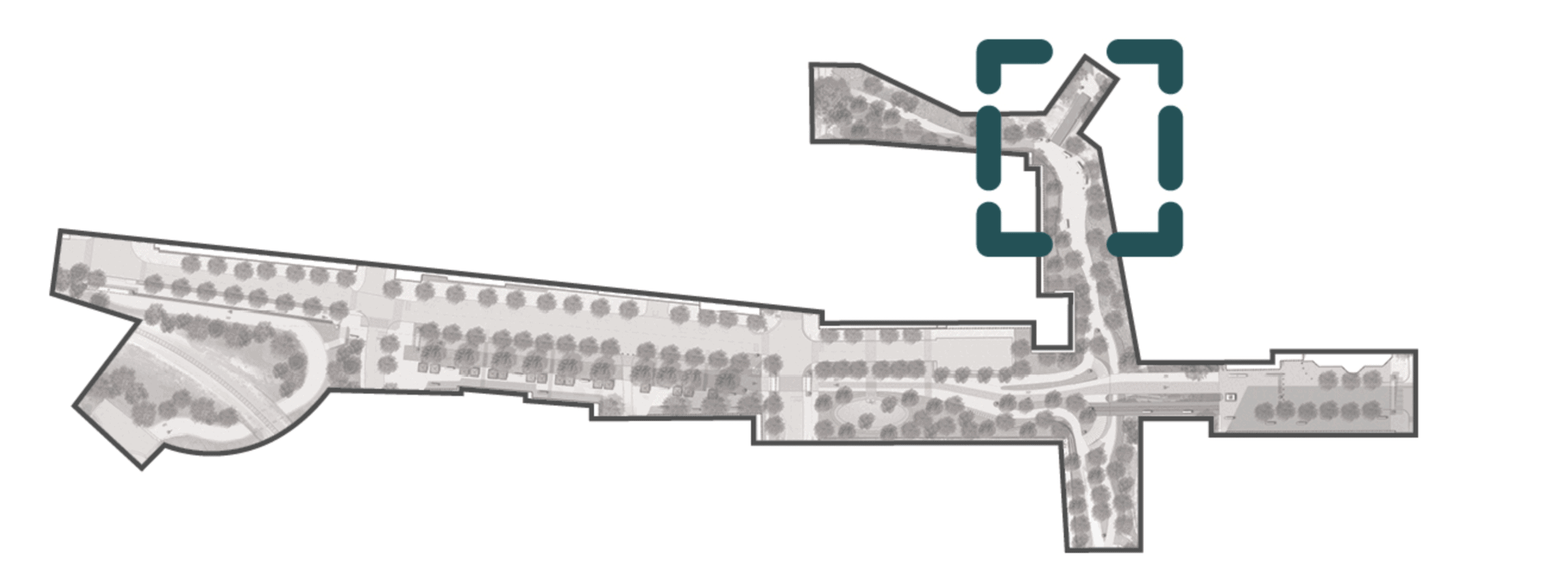
Shoal Creek at Rio Grande Street and 4th Street where Little Shoal Creek daylights, including improvements to the Shoal Creek streambank and trail.
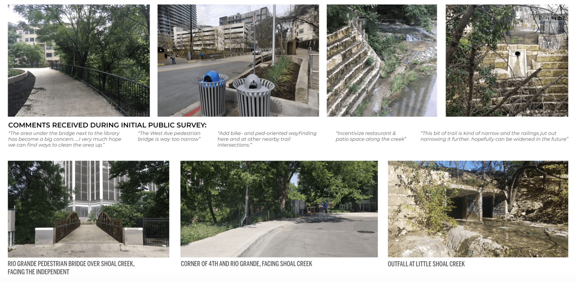
SHOAL CREEK TRAIL AT RIO GRANDE STREET: TODAY
PUBLIC FEEDBACK SUMMARY
- widen the trail
- create a safer trail
- clean up trash and make space feel more space
- create seating areas
OPPORTUNITIES
- widen the trail
- create passive seating areas
- showcase historic Little Shoal Creek
- remove invasive species and restore native habitat
CONSTRAINTS
- narrow conditions
- flood plain
- utilities spanning creek
SHOAL CREEK TRAIL AT RIO GRANDE STREET: CONCEPTS
- capture runoff from the streets in forebays to treat pollutants before entering the creek
- provide educational signage
- provide scenic overlook areas
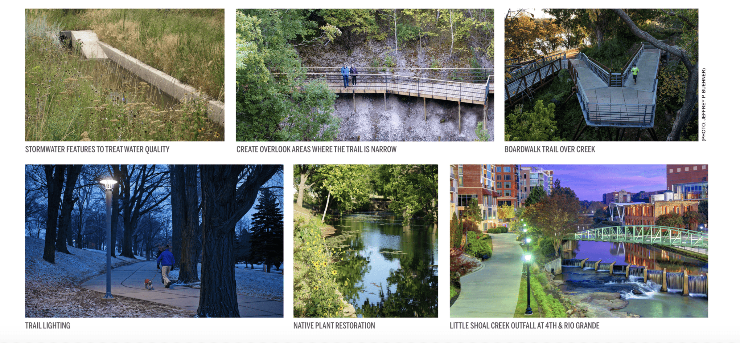
SHOAL CREEK TRAIL AT RIO GRANDE STREET: IN THE FUTURE
GOALS:
- widen trail to provide seating for people watching
- create scenic overlooks
- showcase historic creek outfall
- remove invasive species and re-vegetate with native plantings
- create a safer environment
- provide lighting at night
- clean up trash
- provide educational elements
KEY PLAN
***Please visit the website linked here to give your input.